CloudTAK-Powered Integrations Overview
As part of COTAK the project team has created a data conversion server, which allows external location and mapping systems to be integrated with COTAK. On a best-effort basis the COTAK team works with member agencies to integrate any external systems that are relevant to public safety operations using this server.
The server is focused on converting and importing to COTAK near real-time locations from systems such as automated vehicle trackers (AVL) or computer-aided dispatch (CAD), but can be used on a wide variety of mapping data. Data conversions are operated on a per-channel basis, ensuring that data stays in the custody of the agency who owns it. Contact the COTAK team at cotak.gov/support to learn more about this capability.
Existing CloudTAK-Powered Integrations
The COTAK team will develop new integrations on a best-effort basis, free of charge to COTAK member agencies. Additionally, the following existing integrations can easily be deployed as needed to support COTAK member agencies:
Active911 - Active911 alerts
ADS-B Exchange - Live locations of aircraft in Colorado tracked through the ADS-B Exchange network
A filtered view of EMS medevac helicopters, fire suppression aircraft, and law enforcement aircraft are available on the "Aircraft Tracking" channel
A comprehensive view of all aircraft operating below 18,000 ft MSL are available on the self-serve channel "Aircraft Tracking < 18k"
AirData UAV - Live video from the AirData system when a drone connected to the platform is in flight
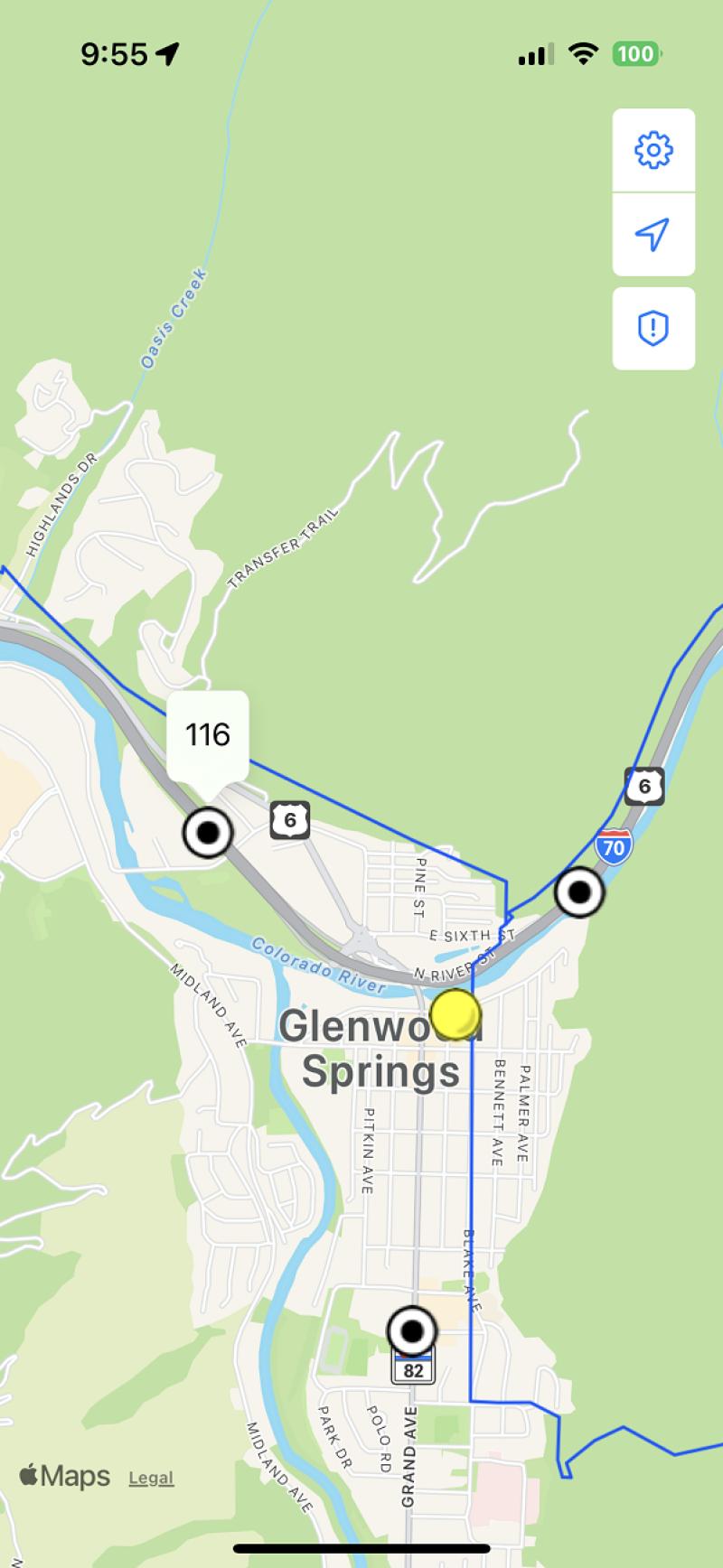
ArcGIS Feature Services - Data can be written from ArcGIS feature services to TAK, and TAK user locations can be written to ArcGIS for viewing in ESRI products
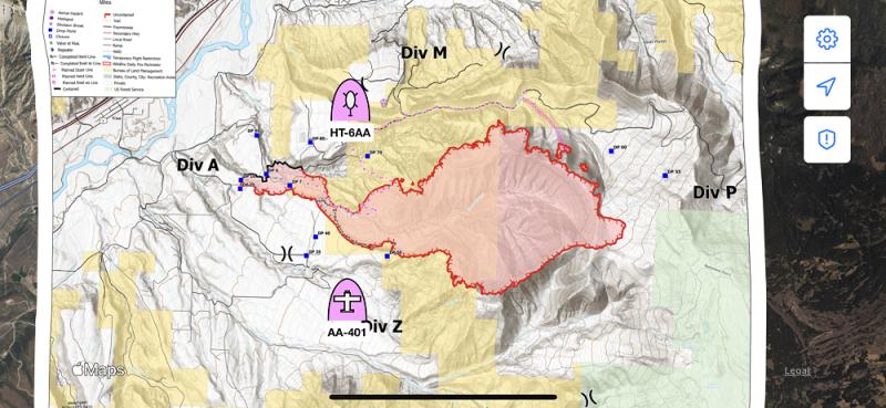
This integration is utilized on the "CO Wildland Fire MAC" channel to provide the locations of currently burning wildland fires & prescribed burns reported to federal dispatch centers, and the locations of lightning strikes from the last 72 hours.
Axon Body Cameras - Locations of Axon Body Cameras (but not the live video from the camera), with options to set if locations are shared only when cameras are recording/activated
CentralSquare CAD - Locations of CentralSquare Public Safety Suite® Pro CAD incidents
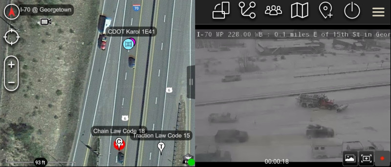
COtrip - Data from the COtrip system operated by the Colorado Department of Transportation
This integration is utilized on the "CO Highway MAC" channel to provide the locations of CDOT snow plows and other vehicles, and the locations of traffic incidents reported to CDOT.
DroneSense - The location of a drone flown using DroneSense, and the location the drone's camera is pointing. A link to watch live video from the drone in a web browser is also available.
Ensurity Mobile Trackers - Locations of Ensurity GPS tracking devices
Everywhere Hub - Locations of satellite messenger devices operated via Everywhere Hub
First Due CAD - Locations of active First Due CAD incidents
Garmin inReach - Locations of Garmin inReach devices
GeoJSON - Strings formatted as GeoJSON, providing functionality with a wide variety of mapping systems
GeoTab - Automated vehicle locator (AVL) data from GeoTab accounts
Optimus Tracker - Locations from Optimus Tracker
SARTopo - Locations of personnel using SARTopo / CalTopo, as well as points and lines collected in SARTopo
Spidertracks - Locations of aircraft equipped with Spidertracks devices
SPOT - Locations of SPOT devices
Skydio Cloud - Live drone positions and status from Skydio drones using their DFR Command software
Skymira - AVL data from SkyMira accounts
USGS Stream Gauges - Locations and current water data on USGS stream gauges covering Colorado, and any flooding status
This integration is used on the "CO USGS Stream Gauges" self-serve channel
Waze - Locations of traffic incidents reported to the Waze system
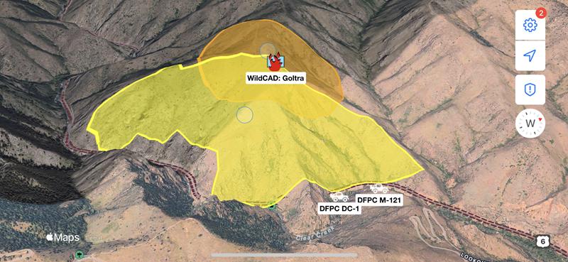
WildCAD - Locations of wildland fires, prescribed burns, smoke reports, and other incidents reported to interagency wildland fire dispatch centers covering Colorado
Live Aircraft Locations
COTAK utilizes a technology called ADS-B to track the locations of public safety-related aircraft. This technology is federally mandated for all aircraft to use in controlled airspace, and provides up-to-the-second tracking of aircraft when they are in view of ground tracking stations.
COTAK has partnered with ADS-B Exchange to utilize their data feed of real-time aircraft locations. Every 10 seconds ADS-B Exchange provides the locations of all aircraft over Colorado to COTAK. A process then filters out all non-public safety aircraft, and passes only the locations of public safety-related aircraft into the “Aircraft Tracking” channel in COTAK, which is available to all COTAK users.
Note that an aircraft only will show up in this feed if at least one ADS-B Exchange ground station is receiving the ADS-B signal of the aircraft. If you wish to improve the aircraft tracking coverage in your jurisdiction you may set up your own ADS-B Exchange ground station, and by doing so you will improve the aircraft tracking coverage for COTAK in your area.
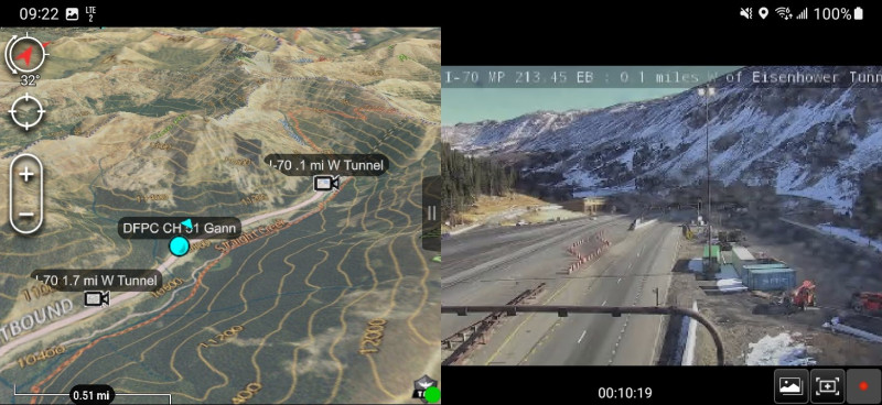
CDOT Live Cameras
The COTAK team integrates a layer of over 800 live video cameras operated by the Colorado Department of Transportation (CDOT) along Colorado highways into our apps. To access this layer COTAK users should turn on the "CO Highway MAC" channel, and search for the data sync mission titled "CDOT Cameras." Subscribe to the mission, and the cameras will appear on the map, and when tapped on live video can be viewed.
Miscellaneous Data Layers
Many types of geospatial data can downloaded and displayed in the TAK apps. The COTAK Server can host these datasets and share them with designated TAK channels.
The COTAK project team has assembled several datasets that are useful statewide. These are shared in the "z_Initial Setup" channel, to access them turn the channel on, then open the data packages tool in the TAK app and search the COTAK Server. Some data packages hosted on the z_Initial Setup channel include:
County & municipal boundaries
Mileposts on interstates and highways
Critical infrastructure
Elevation data, which allows ATAK and WinTAK users to view maps in 3D and calculate line-of-sight