Existing CloudTAK-Powered Integrations
September 18th, 2026
COTAK Team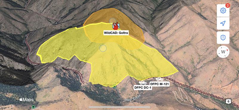
The COTAK team will develop new integrations on a best-effort basis, free of charge to COTAK member agencies. Additionally, the following existing integrations can easily be deployed as needed to support COTAK member agencies:
Active911 - Active911 alerts
ADS-B Exchange - Live locations of aircraft in Colorado tracked through the ADS-B Exchange network
A filtered view of EMS medevac helicopters, fire suppression aircraft, and law enforcement aircraft are available on the "Aircraft Tracking" channel
A comprehensive view of all aircraft operating below 18,000 ft MSL are available on the self-serve channel "Aircraft Tracking < 18k"
AirData UAV - Live video from the AirData system when a drone connected to the platform is in flight
ArcGIS Feature Services - Data can be written from ArcGIS feature services to TAK, and TAK user locations can be written to ArcGIS for viewing in ESRI products
This integration is utilized on the "CO Wildland Fire MAC" channel to provide the locations of currently burning wildland fires & prescribed burns reported to federal dispatch centers, and the locations of lightning strikes from the last 72 hours.
Axon Body Cameras - Locations of Axon Body Cameras (but not the live video from the camera), with options to set if locations are shared only when cameras are recording/activated
CentralSquare CAD - Locations of CentralSquare Public Safety Suite® Pro CAD incidents
COtrip - Data from the COtrip system operated by the Colorado Department of Transportation
This integration is utilized on the "CO Highway MAC" channel to provide the locations of CDOT snow plows and other vehicles, and the locations of traffic incidents reported to CDOT.
DroneSense - The location of a drone flown using DroneSense, and the location the drone's camera is pointing. A link to watch live video from the drone in a web browser is also available.
Ensurity Mobile Trackers - Locations of Ensurity GPS tracking devices
Everywhere Hub - Locations of satellite messenger devices operated via Everywhere Hub
First Due CAD - Locations of active First Due CAD incidents
Garmin inReach - Locations of Garmin inReach devices
GeoJSON - Strings formatted as GeoJSON, providing functionality with a wide variety of mapping systems
GeoTab - Automated vehicle locator (AVL) data from GeoTab accounts
Optimus Tracker - Locations from Optimus Tracker
SARTopo - Locations of personnel using SARTopo / CalTopo, as well as points and lines collected in SARTopo
Spidertracks - Locations of aircraft equipped with Spidertracks devices
SPOT - Locations of SPOT devices
Skydio Cloud - Live drone positions and status from Skydio drones using their DFR Command software
Skymira - AVL data from SkyMira accounts
USGS Stream Gauges - Locations and current water data on USGS stream gauges covering Colorado, and any flooding status
This integration is used on the "CO USGS Stream Gauges" self-serve channel
Waze - Locations of traffic incidents reported to the Waze system
WildCAD - Locations of wildland fires, prescribed burns, smoke reports, and other incidents reported to interagency wildland fire dispatch centers covering Colorado