News
For Media Inquiries please fill out this form.
Passkey Support in COTAK
Remembering your COTAK password and syncing it across your devices can be a challenge, but a new technology called passkeys can help! A passkey provides a different approach to security, by creating a ‘fingerprint’ specific to an individual device like a phone or laptop. You unlock this ‘fingerprint’ using your Face ID, your PIN, or your literal fingerprint, and the passkey then allows you to access the protected site. Passkeys improve security against phishing attacks and eliminate annoying two-factor authentication requests.
The COTAK program has deployed passkeys to log into our cotak.gov website and to access CloudTAK. The requirement to have a password as part of your COTAK account is not going away, since the mobile apps still require users to enter a username and password, but only once per year.
To set up a passkey in cotak.gov log in as normal, then click on your initials in the top right corner of the page and then “profile.” A new option under your profile is now available called “Manage Passkeys” and allows you to make a new passkey for each computer or phone you need to use. In CloudTAK similarly log in normally, then click on “Settings” and the “Login Passkeys” option. Click the + button to set up a new passkey for each computer or phone you need. Once a passkey has been set up you should never have to enter your COTAK password again on that device.
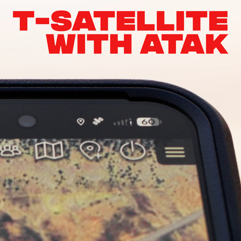
T-Satellite with ATAK
The COTAK team is frequently asked how users can use the apps to communicate in remote areas of Colorado, where cell service is spotty or nonexistent. A significant new option for these situations is cellular capabilities that enable smartphones to communicate directly with satellites overhead.
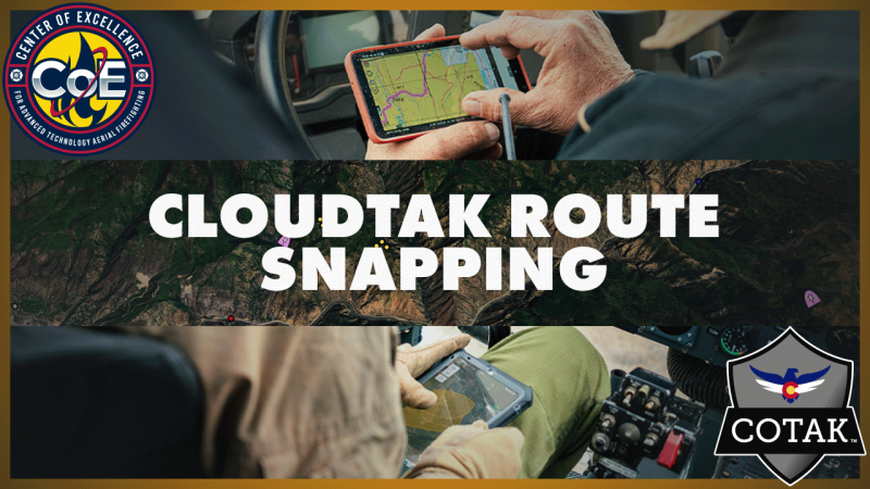
CloudTAK Route Snapping Feature
Route snapping in CloudTAK makes route creation faster and more accurate by automatically aligning user-drawn routes to existing roads and trails in the map dataset. Instead of manually drawing paths, users can create clean, navigable routes that follow real-world infrastructure, which is especially useful for mission planning, navigation, and coordination in the field. This feature relies on underlying road and trail data (such as OpenStreetMap).
The accompanying video demonstrates how to enable route snapping in CloudTAK, when to use it, and practical considerations for working with snapped routes during operational planning and shared situational awareness workflows.
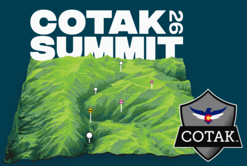
Registration Open for 2026 COTAK Summit
Registration Open
Registration for the 2026 COTAK Summit at the Copper Mountain Conference Center is now open! To register, visit cotak.gov/summit and click the “Registration” link. The cost to attend the Summit is $250 and includes breakfast and lunch during the main Summit (July 8-9), and access to the discounted hotel room block, which will be provided after registration. Space is limited and we expect the Summit to sell out, so be sure to register early!
Pre-Summit Workshops
We’re also excited to offer optional pre-Summit workshops for iOS and Android users the afternoon of July 7. These are intended to provide basic training for new COTAK users on the operation of the apps, and are complementary with your Summit registration. The main Summit will take place July 8–9 and will feature a mix of keynote sessions, operational and technical presentations, and advanced training opportunities, including focused sessions on CloudTAK and agency administrative features.
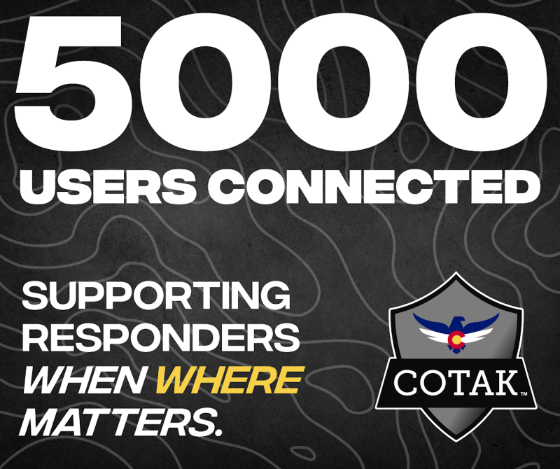
COTAK Celebrates 5000 Users
On January 20, 2026, the COTAK program reached the milestone of 5,000 registered users! Our team greatly appreciates participating public safety agencies in Colorado for trusting us ‘when where matters.’ We are looking to growing the program further and adding exciting new features in the coming months!
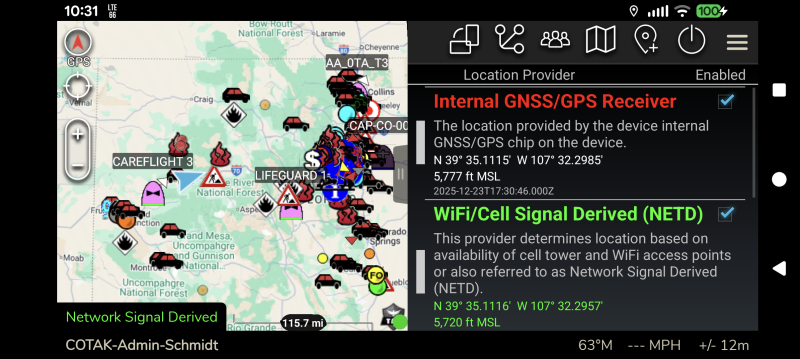
ATAK Indoor Location Enhancements
The Android version of TAK (ATAK) has been updated to version 5.6 in the Play Store. As part of this update ATAK now has the ability to use Google’s location services to locate you, in addition to the device’s internal GPS chip. Activating this feature will improve ATAK’s ability to locate you inside buildings or dense urban areas where GPS signals are degraded. Note that iTAK has an equivalent capability enabled by default, so iTAK users do not need to take any action!
Due to ATAK’s extensive use in the military this feature is not enabled by default. To turn it on users should open ATAK, then tap on the three stacked lines in the top right corner of the app to open the tool list, then tap on “Overlays.” In the Overlay Manager that appears scroll toward the bottom of the list and tap on the “Location Input Manager.”
In this new tool is a list of the possible sources of location data for ATAK. The “WiFi/Cell Signal Derived (NETD)” option is new, and may be checked on to improve ATAK’s location accuracy, as it uses Google’s location services to improve your positioning similar to many other smartphone apps.
Users should leave the “Internal GNSS/GPS Receiver” option checked as well, as this allows the app to use both types of technologies to locate you as accurately as possible. When these settings are applied and GPS is lost, ATAK will begin relying on the network signal to locate you, and a special message will appear in the bottom left corner of the app (see attached screenshot). Note that the bottom options in this tool refer to military GPS units and may be left unchecked.
Save the Date for the 2026 COTAK Summit
The COTAK Program Team invites you to save the date for the 2026 COTAK Summit, scheduled for Tuesday, July 7, 2026, through Thursday, July 9, 2026.
The event will take place at the Copper Mountain Conference Center, located in the heart of Copper Mountain Center Village at 184 Copper Circle, Frisco, CO 80443.
At the COTAK Summit, you can expect to gain hands-on experience with the latest COTAK tools, hear real-world success stories from champion agencies, and connect with leaders driving innovation in public safety. With live demonstrations, training sessions, and networking opportunities, this event offers a unique chance to learn and collaborate, paving the way for a stronger future in public safety.
Registration for the COTAK Summit will open in January 2026, and we will accept registrations from 250 guests on a first-come, first-served basis. Once we reach this capacity, sign-ups for the event will close. Be sure to mark your calendars for January 2026 to secure your spot!
In Spring 2026, the COTAK Program Team will release an agenda outline with more detailed information on breakout sessions and speakers. For now, you can view the latest event details and information on our website at cotak.gov/summit


UAS Tool Training Videos
The COTAK Program team is excited to announce the release of a series of training videos on the Uncrewed Aerial Systems (UAS) tool. The UAS tool is a free plugin for the Android version of TAK (ATAK) that enables you to fly many common drones using ATAK and share information on the real-time location of the drone and even its camera stream with other COTAK users.
Part one of the training covers the installation of ATAK and the UAS tool software on a drone controller (or smartphone), and the process of configuring a drone and flying it using the UAS Tool.
Part two of the training covers the process of live streaming the drone’s video to other COTAK users. The COTAK team offers a live video server which routes the drone’s video stream to other users with minimal lag, and this video details how drone pilots can create a new stream using the CloudTAK user interface, how to enter stream information into the UAS Tool, and how to initiate a live stream.
As always, our team is here to support you. If you need further assistance with UAS Tool or other drone integrations, please submit a support ticket, and one of our team members will be happy to assist you.
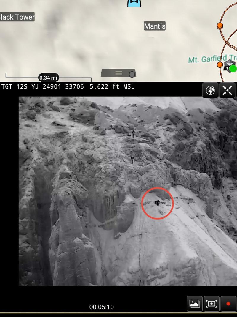
Mesa County Search and Rescue Successfully Rescued a Climber Using COTAK's Uncrewed Aerial Systems Integration
Story courtesy of Mesa County Search and Rescue
On Saturday, Sept 20, at approximately 8:00 PM, Mesa County Search and Rescue was paged for a subject who became cliffed out while on Mt. Garfield. The subject reported no injuries but was unable to safely descend on their own.
Team members and a UAV were deployed. With new technology, the drone broadcast a live video feed to all team members through COTAK (a navigation & situational awareness app), giving them real-time visuals of the subject’s position and the surrounding terrain. The subject was located just below a 20–30 foot vertical rock face on steep, unstable terrain. Due to significant rockfall risks and poor anchor options, a top-down rescue was deemed hazardous.
A bottom-up approach was initiated and contact with the subject was made at approximately 12:00 AM. The subject was given a harness and helmet and carefully guided to safety using a combination of short roping & short pitching. This approach provided the added protection of a rope belay while navigating the terrain. All team members and the subject safely exited the field by 1:00 AM.
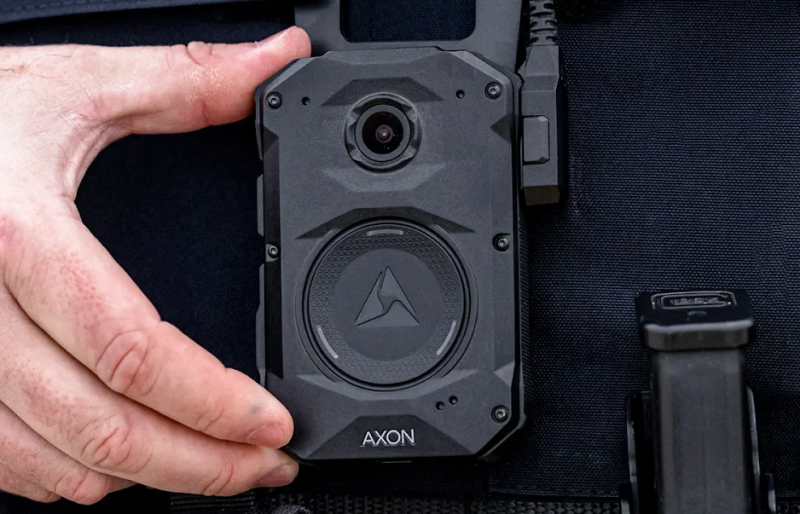
Axon Body Camera Location Integration Now Available
COTAK now has the ability to display the near real-time locations of Axon body cameras! This integration allows COTAK users on your agency’s channel(s) to see the location and the callsign associated with the camera on the map in any of the TAK apps. This integration does not provide live video from the camera, and is configurable to include the location of your officers whenever their camera is turned on, or to only include the location when the camera has been set in recording mode.
Like all COTAK integrations, Axon is offered free-of-charge to COTAK member agencies, though you will need to provide us with a key to your existing Axon account for our staff to set up the integration. Your agency administrator for Axon may follow the directions here to pull the needed information to set up the integration, which they can provide to the COTAK support team by filing a ticket to request the integration at cotak.gov/support.
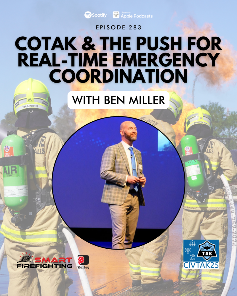
COTAK Featured in Smart Firefighting Podcast
CoE Director Ben Miller recently had the opportunity to be interviewed on the Smart Firefighting podcast. In the podcast, he discusses strategies for facilitating technology adoption and improving infrastructure for public safety agencies, among other topics. You can listen to it on all popular platforms including Apple Podcasts and Spotify or CLICK HERE to listen now!
Smart Firefighting is a podcast covering technologists, innovators, companies, and forward-thinking public safety agencies with real-world deployments of smart tech.
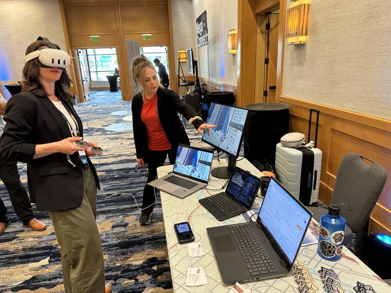
COTAK Attends 5x5 FirstNet Conference in Seattle
Last week, CoE staff members Adrien Hoff and Brad Schmidt attended the 5x5 FirstNet conference in Seattle.
Throughout the week, staff had the opportunity to learn about cutting-edge public safety technologies and network with experts from around the world. We presented on COTAK and demonstrated it to attendees, including the virtual reality TAK client, VR TAK.


