News
For Media Inquiries please fill out this form.
New Basemaps Added to CloudTAK
September 22nd, 2026
COTAK Program Team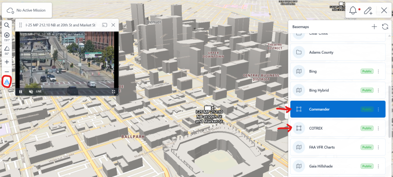
CloudTAK (map.cotak.gov) now supports a dark mode, for nighttime operations or simply for reducing eye strain. To turn on dark mode in your settings select "Display Preferences" and find the preference for "Light/Dark Style."
New base maps have also been made available for CloudTAK. These maps are 'data defined' instead of being simply images, and are more efficient to load and enable advanced features, such as the labels rotating if you change the direction the map is pointing. To find a data defined map look for the "square with 4 points" icon next to the basemap (as opposed to the trifold map icon, which indicates a traditional image-based map).
These new maps include the "Commander" map which uses Open Street Map data, and automatically changes color as you switch from light to dark mode in CloudTAK. This map also includes 3D buildings when CloudTAK is tiled into 3D over select areas of Colorado as well as building addresses.
The COTREX map has also been added, which features a topographic map and rich data on trails curated by Colorado Parks & Wildlife. To view these maps simply open the basemaps tool in CloudTAK and click on the map of your choice.